Friday, October 19, 2007

Implications of the Rappanos Case on Current Development

The last few months’ blogs have provided a background for the Rappanos case and outfalls, but what does it really mean to the regulated. Now that the COE has prepared its guidance and completed initial field training of its staff, what will this case mean to the regulated community (i.e., developers and contractors)? An active project is presented to generate discussions on the actual implications to developers and what might be done to expedite the process.

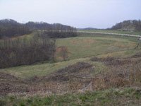
A family farm containing rolling meadows, perennial stream, pond, wetlands, and drainage swales or areas was purchased for construction of residential dwellings. The potential impacts to “waters of the state” were greater than 300 feet and an individual permit (IP) through the COE would be required. Here’s the permitting process and schedule:

  • Blackout period (2006 – 5 June 2007) for pre-application site visits.
  • Nationwide permits reauthorized but without state water quality conditions.
  • States had to prepare conditions and go through public notice process, which resulted in several months delay in permit approvals.
  • COE application submitted in May 2007.
  • Coordinating agencies (SHPO, USFWS, DNR, Public Lands, and 401 Water Quality) were contacted directly in May 2007 and clearance letters were obtained.
  • Stream and wetland delineation report submitted in June 2007.
  • Jurisdictional determination accepted in late August 2007. (Delay due to new guidance and training of COE staff)
  • Archaeology work completed and approved in September 2007.
  • Public notice published by the COE on 17 September 2007.
  • Mitigation plan submitted to all agencies and COE in early October 2007.
  • Alternatives analysis, water resources study, and other undetermined requirements needed by COE to complete the IP package being prepared in October and November 2007.
  • Regulatory timetable for authorization of IP is a minimum of 120 days following completeness review.
  • Possible project approval date is end of December 2007 due to political influence.


  • The reauthorization of Nationwide permit process (no pre-application site visits), regulatory process for approval of state water quality conditions, and the Rappanos decision have resulted in an extended permitting process, loss of summer and fall construction seasons, possible loss of matching federal monies, and additional labor for both regulators and engineering contractors. The current IP process will be a minimum of 8 months even with the consultant’s contacting coordinating agencies directly, providing of plans in anticipation of COE requests, and political pressure. As a colleague said in passing, “ Maybe we could draft the permit for COE to help them out”, how else can the regulated help?

    Monday, September 24, 2007

    In our last blog, we addressed Virginia’s method for funding land conservation – tax credits to landowners via conservation easements.

    The Charleston Gazette published an article a few weeks ago titled “Keeping it Wonderful,” talking about West Virginia’s take on the idea of funding land conservation.

    The article states that for the past five years, WV counties have been able to tax all real estate transfers and use the money to buy development easements from farmers who wanted to sell them. Advocates argue that without the payment, farmers would be more likely to sell their land to high-paying developers.

    According to a poll by the West Virginia Division of Natural Resources, conservation easements have become an increasingly popular topic among West Virginia legislators as well as residents. The telephone poll of 2,505 people states that four out of five West Virginians would support spending tax money on the preservation of forests, mountains and natural areas within the state.

    Currently, although the public demands that the DNR conserve more land, it simply can’t keep up due to budget issues.

    According to the Gazette, MeadWestvaco – a packaging and products solutions company that promotes its dedication to environmental, social and economic sustainability – was selling approximately 60,000 acres of property in Randolph County with a price tag of more than $93 million.

    Steve Brown, fish and wildlife planner for the DNR’s wildlife resources section explains the DNR’s statewide budget for land acquisition is approximately $1 million, thus illustrating the budget constraints.

    Clearly, the state of West Virginia can’t remain undeveloped. That’s not smart economics for anyone.

    However, it’s important to consider the development ramifications on the tourism industry in West Virginia.

    According to a U.S. Fish and Wildlife census, people spent approximately $1.2 billion on hunting, fishing, birdwatching and other wildlife activities in West Virginia last year.

    Should the land development industry get behind the issue in thinking about smart growth?

    Let us know your thoughts…

    Monday, August 27, 2007

    Conservation Easements a Risk for Development?

    The Roanoke Times recently ran a story about conservation easements and the effects they have on land development and owner profit.

    For those who might need a refresher, conservation easements (also known as land trusts) are an agreement between a landowner and a conservation organization to limit or prevent property from being developed. Land owners often get tax incentives for establishing a conservation easement because they’re seen as charitable gifts by federal and state authorities if certain standards are met. Excess tax credits (over what a landowner owes), can even be sold (usually for around 75 to 80 cents on the dollar).

    In the ever-growing Mid-Atlantic region of the United States, conservation easements have become increasingly popular. But does this negatively impact progress? Sure, it’s admirable to protect land for future generations. And it’s certainly something to think about when green fields disappear overnight to “Anywhere, USA” sprawl. (We’ve all heard and can identify with the numerous versions of “Big Yellow Taxi” on the radio).

    Here’s the deal. Progress is eminent. Progress is necessary. And, progress can be smart.

    In other words, development can happen (and often does happen) with careful consideration to the environment, the aesthetics of a place and to the benefit of revitalization goals or economic sustainability of a community.

    Redevelopment on a brownfield (sometimes called an infill) is a great example. Here, a site (usually in an urban setting) that has been previously contaminated or contains potentially hazardous materials is cleaned and developed for another use. Redevelopment on a brownfield often shows efficient use of available resources and results in positive impacts on both the environment and a community.

    Greenfield development (development on previously unused land) that incorporates the idea of smart growth is also a great example. The Urban Land Institute published a study titled “Green Development Without Sprawl: The Role of Planned Communities,” which discusses the benefits of greenfield development within planned communities as conserving open space, preserving community character and heritage, preserving environmental attributes and providing a greater opportunity for mixed use and transportation improvements within a community.

    While valuable, conservation easements risk threatening smart land development and progress.

    What are your thoughts on the issue? Let us know and we’ll discuss…

    Tuesday, July 10, 2007

    In an effort to address concerns from the U.S. Supreme Court regarding its waterways jurisdiction, the U.S. Army Corps of Engineers, along with the US Environmental Protection Agency, released a new set of guidelines on June 5, 2007 stating it will continue to oversee rivers and streams – including ephemeral streams – based on a series of tests developers must pass.

    In June 2006, the Supreme Court ruled that the Corps’ definition of its jurisdictional waters “intruded into issues surrounding land use, which is an area traditionally under state authority.” Authorizing federal action in that area “stretched the limits of Congress’s commerce power” and was therefore flawed.

    To see a synopsis of the court case that led to the debate and resulting guidelines, click here.

    In combination with the “Significant Nexus Test” recommended by the Court, the new guidelines state that jurisdictional waters are divided into two categories and must pass both the Scalia Plurality and Kennedy Concurrence tests – named after two of the 9 U.S. Supreme Court justices who opposed the Corps’ decision to halt two development projects in violation of the Clean Water Act.

    To see the new guidelines, visit the US EPA website.

    These issues largely impact land development in the Mid-Atlantic region – especially West Virginia – because many streams impacted are streams that only flow during times of precipitation. With the new guidelines, all headwater streams will be analyzed on a case-by-case basis that will determine whether the Corps has jurisdiction.

    The coal industry worries how this new set of guidelines will impact what it considers the best available technology – the sediment pond – to reduce the amount of sediment or soil material that flows downstream during times of operation. In fact, according to The State Journal, West Virginia Coal Association spokesperson Jason Bostic thinks it’s a matter of time before the regulations affect other areas of the land development industry as well.

    Change is as old as the earth. Certainly, we want to preserve and be respectful of the environment. But in order to prevent undo delays and possible prohibitions that these new guidelines may cause land developers, we should carefully examine the balance between progress and preserving/conserving our environment.

    The land development industry is nearly at the point where any individual disturbance due to development is going to require a permit.

    “Cost and time associated with permitting under the new guidelines may make it prohibitive for the entrepreneur to develop his or her property,” said Bill Hilborn of Kanawha Stone Company – a heavy highway and site development construction company located in Poca, W.Va. “We are looking at a six month cycle for permitting under these guidelines with a high preparation cost. That doesn’t count the cost of mitigation.”

    Permitting through the Corps has taken considerable amounts of time in the past and will only continue to get worse under its new guidelines, which will require the case-by-case assessment of jurisdictional rights. The Corps has a limited staff and the workload is going to increase.

    Can the land development industry handle the potential threats these guidelines may cause? Let us know your thoughts.
    Monday, June 25, 2007

    New blog addresses land development and planning issues in the US Mid-Atlantic region.

    Welcome to the Mid-Atlantic Land Development blog!

    If you’re a member of the land development community or take a particular interest in land development and planning issues, we hope this blog will serve as a valuable resource for you.

    Originated by a team of land planning and construction professionals, this blog will address aspects such as site development, infrastructure, civil engineering, surveying and mapping, geotechnical engineering, environmental issues, and street, road and bridge design, just to name a few.

    We currently represent the following states within the mid-atlantic region: Kentucky, Maryland, Ohio, Pennsylvania, Tennessee, Virginia and West Virginia.

    Let us know your thoughts on the various topics you would like to discuss in the coming weeks and we’ll make an effort to address them. Until then, look forward to next week’s blog about recent changes in headwater jurisdiction regulations.